Key Takeaways
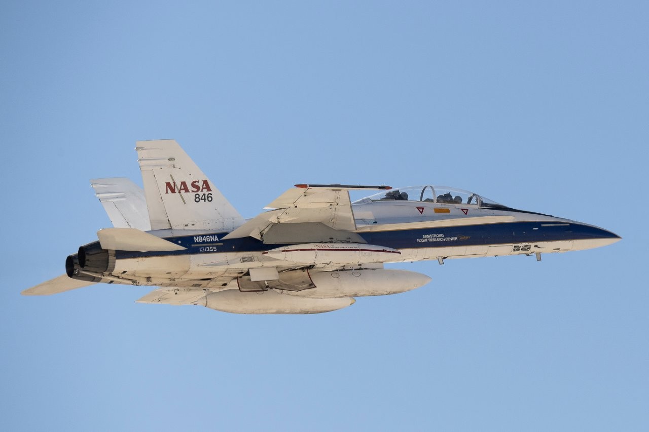
- NASA tested the Psionic Space Navigation Doppler Lidar (PSNDL) system on an F/A-18 Hornet aircraft to enhance navigation technology for lunar and Mars missions.
- The PSNDL combines advanced sensor technology with cameras and an inertial measurement unit for precise vehicle navigation and landing.
- Testing was conducted over multiple days to gather data essential for safe landings in challenging environments, like the lunar South Pole and Mars terrain.
NASA Tests Advanced Navigation Technology for Space Exploration
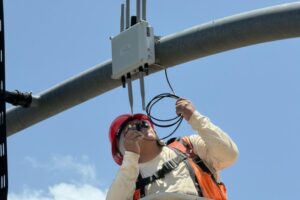
NASA has conducted flight tests utilizing a miniature space navigation system known as the Psionic Space Navigation Doppler Lidar (PSNDL), which is designed to improve navigation accuracy for future lunar and Mars missions. This testing took place under the wing of an F/A-18 Hornet aircraft flying over California, reaching speeds close to that of sound.
The PSNDL draws its foundation from NASA technology that has been licensed and further developed by Psionic, Inc. based in Hampton, Virginia. Through miniaturization and enhancements to the original technology, Psionic has created a robust navigation system equipped with additional functionalities and redundancies to withstand the rigors of spaceflight. The PSNDL comprises not just the lidar system but also cameras and an inertial measurement unit, forming a complete navigation package capable of pinpointing a vehicle’s position and velocity for precise landings.
The flight trials commenced from NASA’s Armstrong Flight Research Center in Edwards, California, where the aircraft executed various flight patterns over the course of several days in February 2025. Among these maneuvers were a large figure-8 loop and dynamic approaches over Death Valley, aimed at collecting navigation data under differing altitudes, velocities, and orientations. Such data is crucial for ensuring successful entry and descent on both the Moon and Mars.
Utilizing Doppler lidar sensors yields highly accurate speed measurements by analyzing frequency shifts in laser light as it is reflected off the ground. This method proves especially valuable in areas with challenging lighting conditions, such as the lunar South Pole, which features lengthy shadows and stark contrasts. The integration of PSNDL with cameras allows for the visual comparison of real-time images against reconnaissance maps, aiding navigation to optimal landing sites on Mars. The system processes all this information in real-time, facilitating swift and safe touchdown decisions.
Since licensing the original navigation technology in 2016, Psionic has benefited from funding and developmental resources provided by NASA’s Space Technology Mission Directorate, through initiatives like the Small Business Innovative Research (SBIR) program and the Tipping Point initiative. Additionally, the PSNDL prototypes have been tested on suborbital vehicles under the Flight Opportunities program. In a notable demonstration in 2024, NASA successfully showcased its earlier navigation technology on a commercial lunar lander, setting the stage for future advancements in space navigation systems.
Overall, the tests of the PSNDL system highlight NASA’s commitment to enhancing navigation capabilities, ensuring that astronauts and robotic explorers can land efficiently and safely on other celestial bodies.
The content above is a summary. For more details, see the source article.