


Key Takeaways
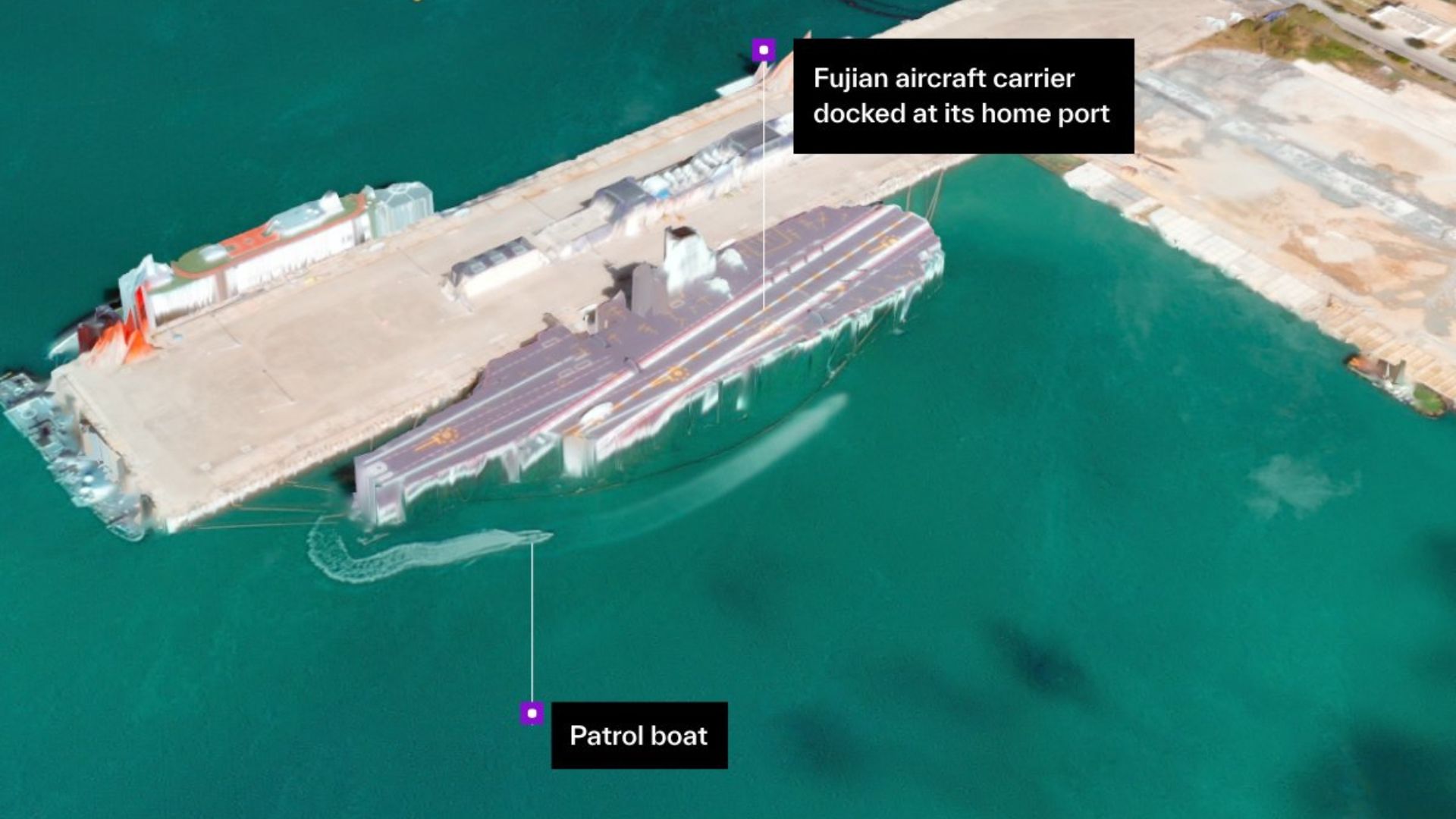
- Vantor demonstrated high-resolution satellite imagery of China’s Yulin Naval Base, achieving 50cm resolution and sub-4m accuracy.
- The imagery was created from a single satellite pass and processed in under 10 hours, offering valuable insights for analysis and planning.
- Vantor’s technology combines AI and 3D modeling to aid various sectors, including military and urban planning.
Advanced Satellite Imaging by Vantor
Vantor, a U.S. satellite company, recently revealed its satellite imaging capabilities by sharing high-resolution images of China’s Yulin Naval Base located on Hainan Island. The images feature a remarkable resolution of 50cm, providing sub-4-meter spatial accuracy, which was achieved with just one satellite pass and processed within ten hours. While these images do not provide live feeds, they offer enhanced insights for analysis, reconnaissance, and operational planning. Users can also interact with the imagery in full 3D using Vantor’s Forge software.
The company noted, “We generated this high-resolution 3D terrain from a single satellite pass at 11:21 a.m. local time today,” highlighting the efficiency of their processing capabilities. Vantor emphasized that command systems and autonomous platforms depend on accurate spatial data, which is continually updated to ensure it meets mission requirements.
The potential of satellite imagery extends significantly, as processing such data typically demands extensive human expertise and time. Vantor seeks to alter this dynamic by leveraging artificial intelligence, enabling clients to create digital twins of observed sites. This innovation aids a range of users, from civilian authorities engaged in urban planning and emergency response to military personnel planning operations.
The sharpness of Vantor’s final images, with a pixel size equivalent to 20 x 20 inches, allows for detailed observation, potentially identifying individual vehicles on the ground. This clarity, combined with 3D visualization, enhances the capability of analysts to interpret the data.
Further, the integration of high-resolution imagery with machine learning technologies streamlines the analysis process for intelligence experts, who must handle vast volumes of data from numerous sensors throughout the year. This advancement raises concerns among some U.S. government officials regarding the potential use of advanced American chips by China, given their dual-use applications in both civilian and military contexts.
Vantor’s cutting-edge technology marks a significant step forward in satellite imaging, underscoring its value across various sectors while eliciting important discussions around data security and international implications.
The content above is a summary. For more details, see the source article.


