


Key Takeaways
- A new open-source model helps city planners monitor urban vegetation changes using satellite imagery and machine learning.
- The model revealed a yearly decrease of 0.3% to 0.5% in street canopy coverage, highlighting inequalities in green spaces across cities.
- It enables targeted planning and maintenance of vegetation in high-density areas with low Green View Index (GVI).
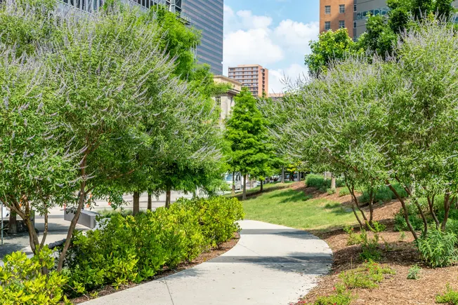
Monitoring Urban Vegetation
A new open-source model from the International Institute for Applied Systems Analysis (IIASA) enables city planners to continuously monitor urban vegetation changes using satellite imagery and machine learning techniques. The model utilizes global data to evaluate changes over time and has revealed concerning trends in city greenery.
The findings show that the Green View Index (GVI), which measures canopy coverage, is declining at a rate of 0.3% to 0.5% annually. The research pointed out significant variability between cities and stark inequalities in the distribution of green spaces within urban areas. Giacomo Falchetta, an IIASA research scholar and lead author of the study, emphasized that the model provides insight into the structural changes affecting canopy cover due to factors such as land use and vegetation health.
The Importance of Urban Vegetation
Urban vegetation plays a crucial role in mitigating urban heat islands, managing flood risks, sequestering carbon, preserving biodiversity, and enhancing both human health and property values. Despite its benefits, city planners face numerous challenges in increasing street greenery. These challenges include identifying suitable areas, regulatory hurdles, funding for planting and maintaining vegetation, water resource management, and potential side effects like pest proliferation and vector-borne diseases.
Falchetta highlighted that many cities lack consistent, street-level data related to vegetation coverage, which complicates efforts to prioritize greening initiatives based on existing inequalities and environmental conditions.
Supporting Inclusive Planning
The IIASA study focused on GVI distribution within the ten most populated urban areas across 19 global regions. The model provides a framework for city planners to analyze population characteristics, such as social vulnerability, within urban districts. By doing so, it supports more inclusive street greenery planning in areas that are underserved but have high population density.
The model also assists in identifying intersections of low GVI with high population density, allowing planners to prioritize maintenance in regions where greenery is declining. This targeted approach not only enhances urban resilience but also directs resources to areas that are most in need.
Another advantage of the model is its open-source nature, which enables cities to utilize it with basic technical infrastructure. With a straightforward setup process and a two- to three-day training for urban planning personnel, cities can effectively implement the model to enhance their urban green spaces.
In summary, the emerging model by IIASA represents a significant advance in urban planning. It equips city planners with the tools to combat urban greenery decline and fosters a more equitable distribution of green spaces, improving urban environments for all residents.
The content above is a summary. For more details, see the source article.


